CRISTM

Climate Risk
Intelligence SystemTM

Forecast storm and wildfire outages and damages quickly, restore safely, communicate accurately, and build climate resilience.

Get a Demo

AiDash launches new Climate Risk Intelligence System Read More

More than 125 utilities of all sizes across the globe use AiDash climate technology

Faster Icon
30%
faster restoration
lower cost icon
25%
lower storm costs
accuracy
85%
accuracy forecasting outages
Grid Icon
15%
fewer power outages in storms
World Map

Pre-Event

Predict, prepare, and deploy accurately.

Post-Event

Monitor, survey, and restore faster.

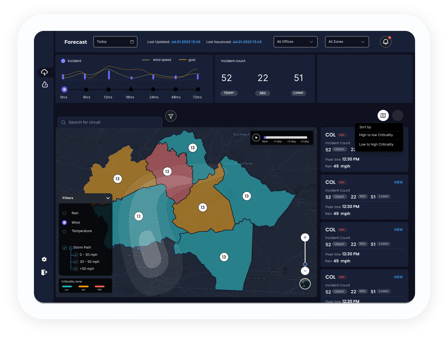
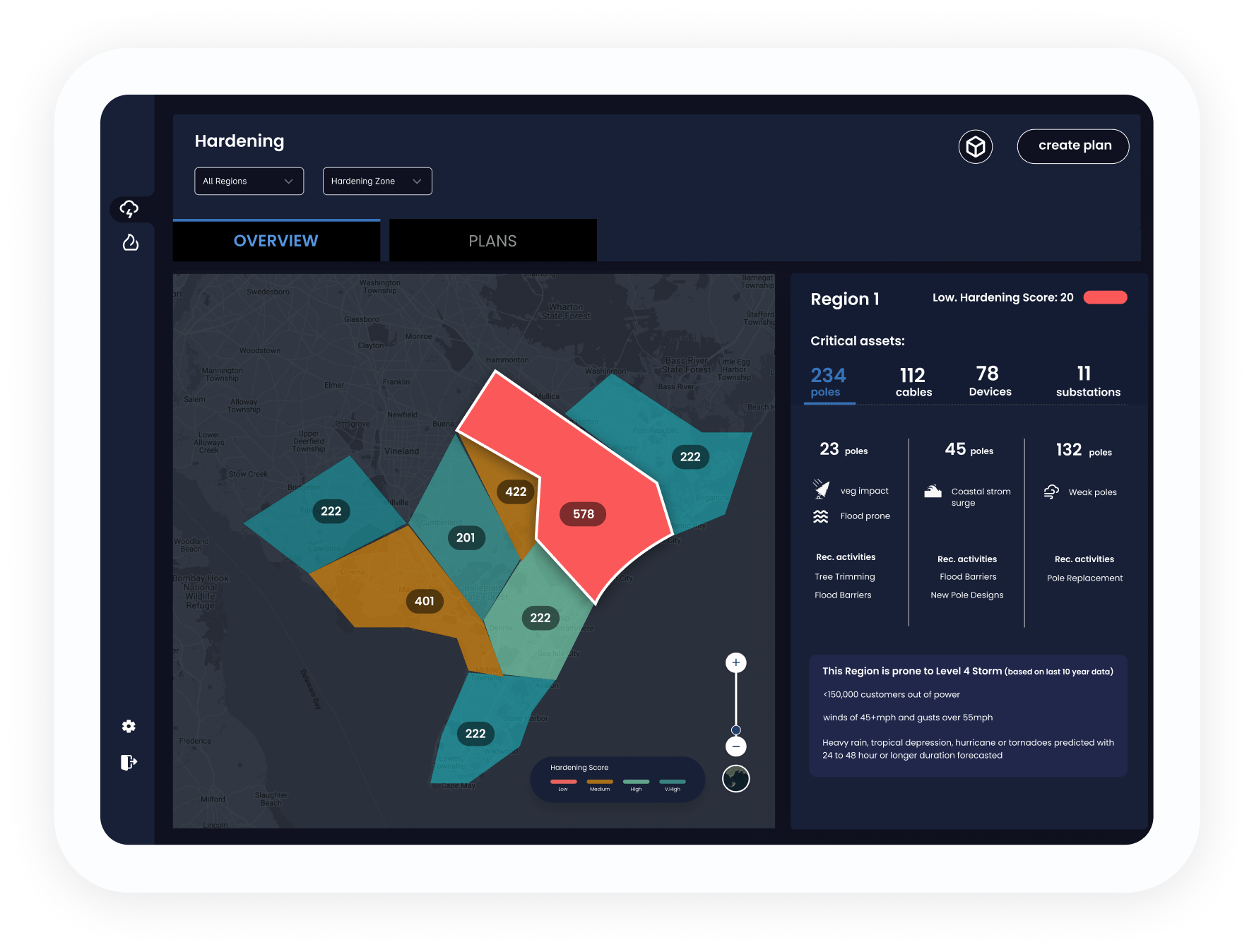
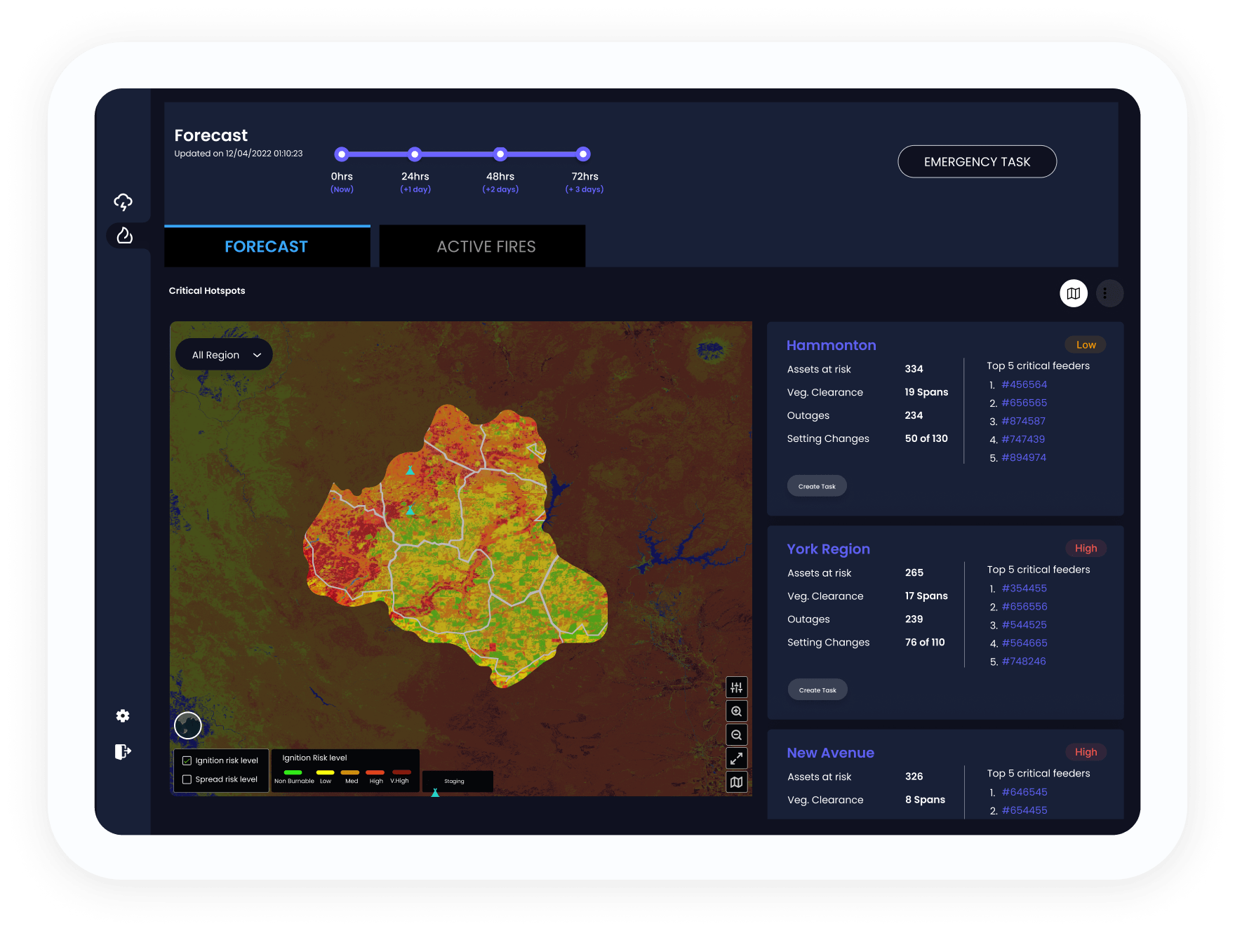
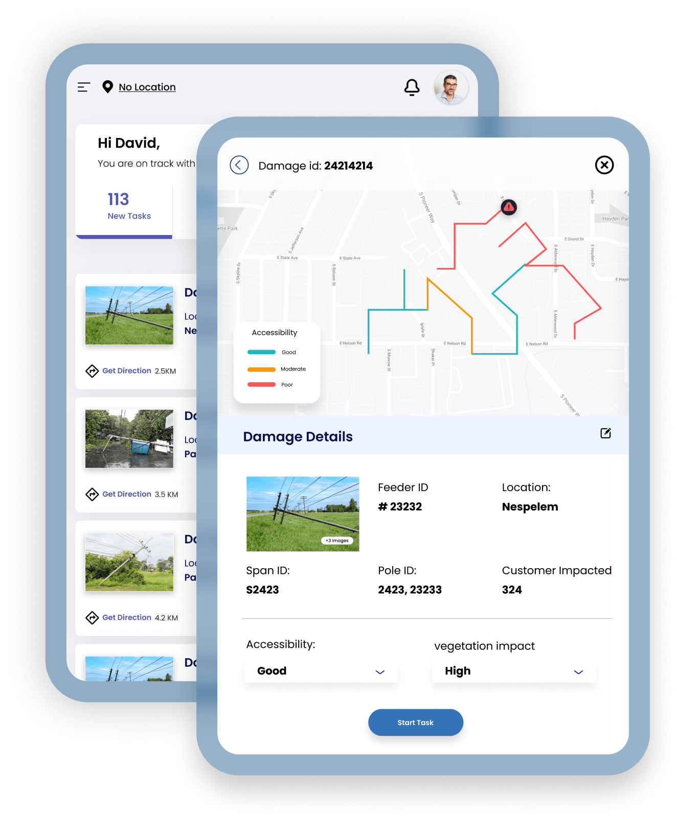
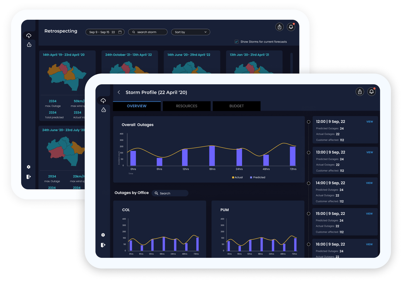
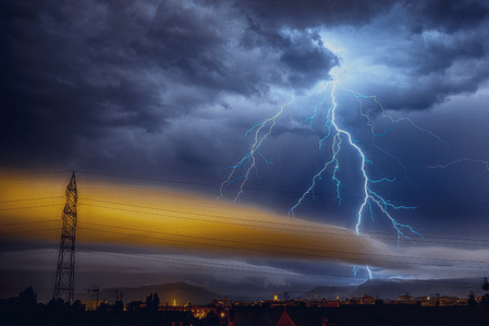
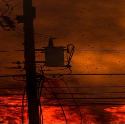
Weather any storm or wildfire

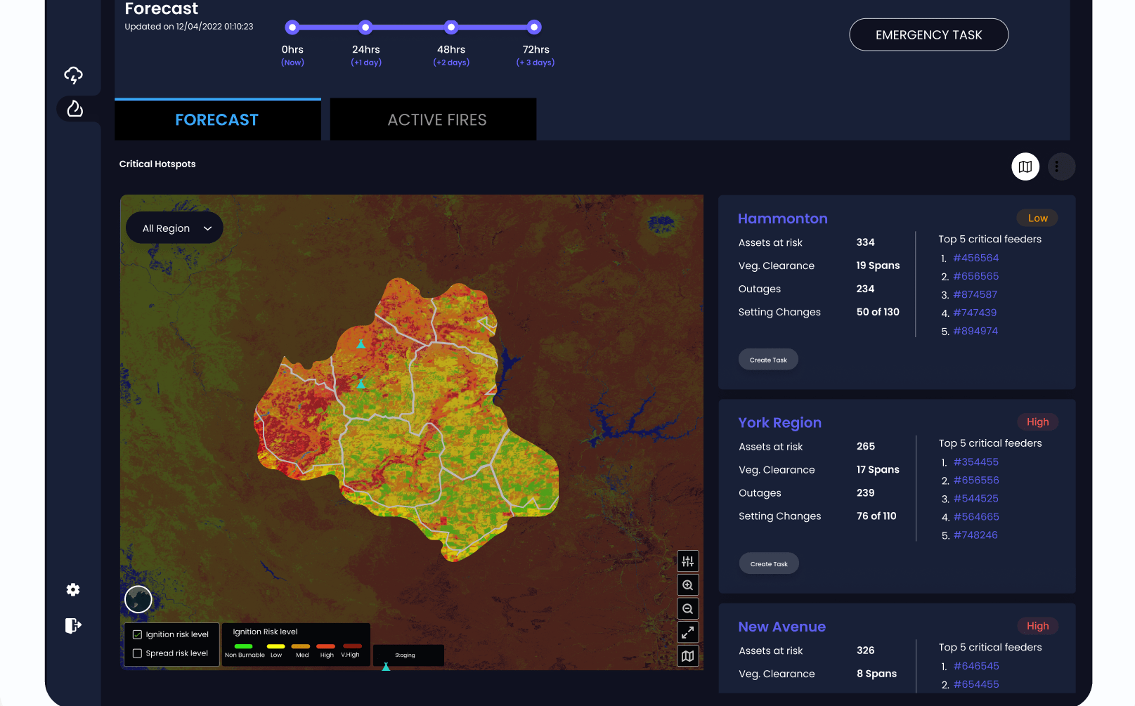
Work with satellite imagery, real-time weather data, and span-level vegetation data to bolster preparedness — in one agile, user-friendly platform. Mitigate risks before, during, and after a storm or wildfire to minimize customer interruptions.

  • Predict outages with reliable information as early as 72 hours before landfall.
  • Safely assess and access damage remotely to prioritize your responses.
  • Estimate resources to prepare your field, engineering, and operations.
play

Disaster Talks: How to prevent wildfires for electric utilit...

Watch the Interview

play

Disaster Talks: How to prevent wildfires for electric utilities

Watch the Interview

Manage disaster planning and grid hardening

Transform your reliability. Estimate reduced risk, calculate cost, and determine ROI from grid hardening initiatives. Plan hardening opportunities with historical data about outages, damages, system design ratings, and more.

  • Have a dependable repository to handle all critical information.
  • Compare different plans based on multiple constraints.
  • Assign tasks and track progress easily, with clear reporting.
  • Dynamically reassess hardening projects as field conditions change.
webinar

Wildfire and risk mitigation using satellite analytics: Avi...

See Webinar

webinar

Wildfire and risk mitigation using satellite analytics: Avista's journey

See Webinar

Predict storm outages and wildfire spread

In one system, track weather parameters hourly and spot damage-prone areas, predict outages, and prioritize resources and logistics.

  • Rely on advanced weather tracking of wind speeds, rainfall, pressures, and temperatures.
  • Forecast fire weather, wildfire risk, outages, and resource needs for up to 72 hours.
  • Predict storm and wildfire impacts at feeder, segment, and span levels.

Synthetic aperture radar: The hero tool for remote sensing...

See the Blog

Synthetic aperture radar: The hero tool for remote sensing

See the Blog

Accelerate disaster restoration and recovery

Prioritize scouting tasks, reduce assessment times, and increase workforce productivity. Use accurate restoration time estimates to transform customer satisfaction.

  • Identify critical hotspots: measure flood extent, map inaccessible areas, assess wildfire burn severity and damages.
  • Assess damage through darkness and clouds with synthetic aperture radar (SAR) from satellites.
  • Record field assessments and observations with a mobile application for notes, photos, and comments.
  • Simulate restoration based on resources, cost, and time with automatic, prioritized work assignments.

Disaster Talks: Going from hurricane to power on, faster...

Watch the Interview

Disaster Talks: Going from hurricane to power on, faster

Watch the Interview

Use historical data for exact predictions

Evaluate the impact of an active storm by comparing it to historical data of similar storms, including wind speed, pressure, rainfall, and degree of damage.

  • Compare changes from season to season, and year over year.
  • Rely on real data from actual outages, damages, and predictions.
  • Export reports and dashboards in multiple formats.
electric-utility

Electric utilities are experiencing greater regulatory inves...

electric-utility

Electric utilities are experiencing greater regulatory investigations over outages and wildfires.