Survey thousands of miles in a day. Only with satellites and AI.
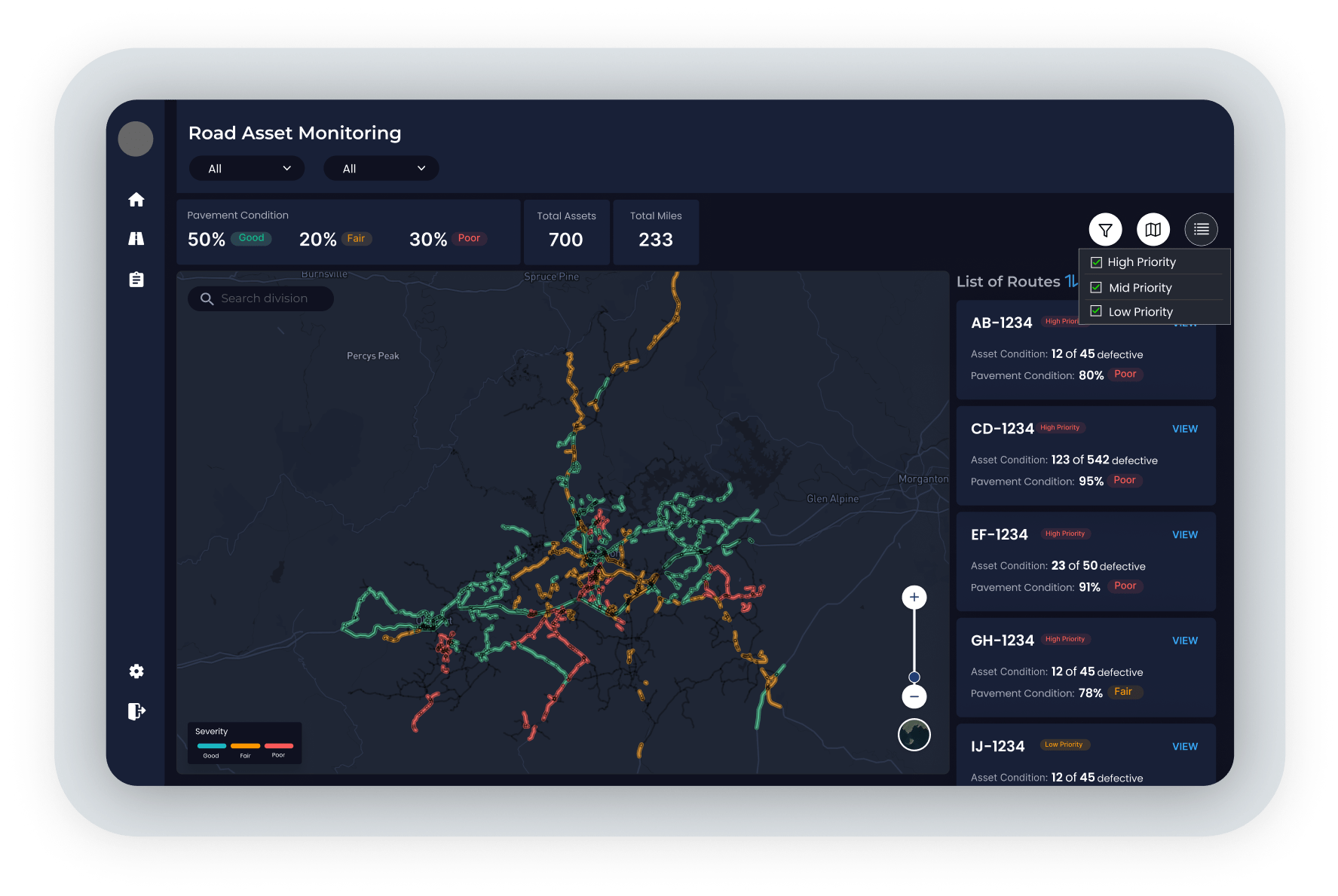
Visualize and assess your entire network of roadways and railroads.
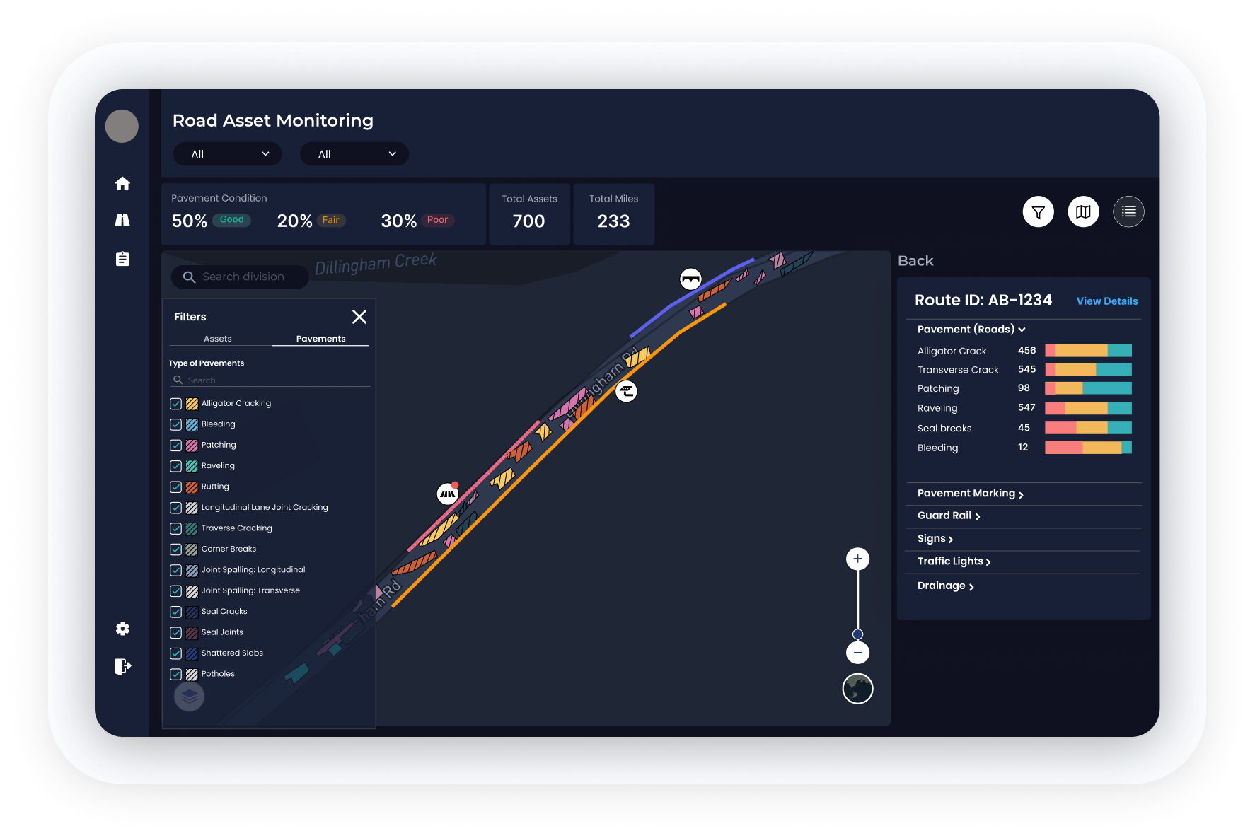
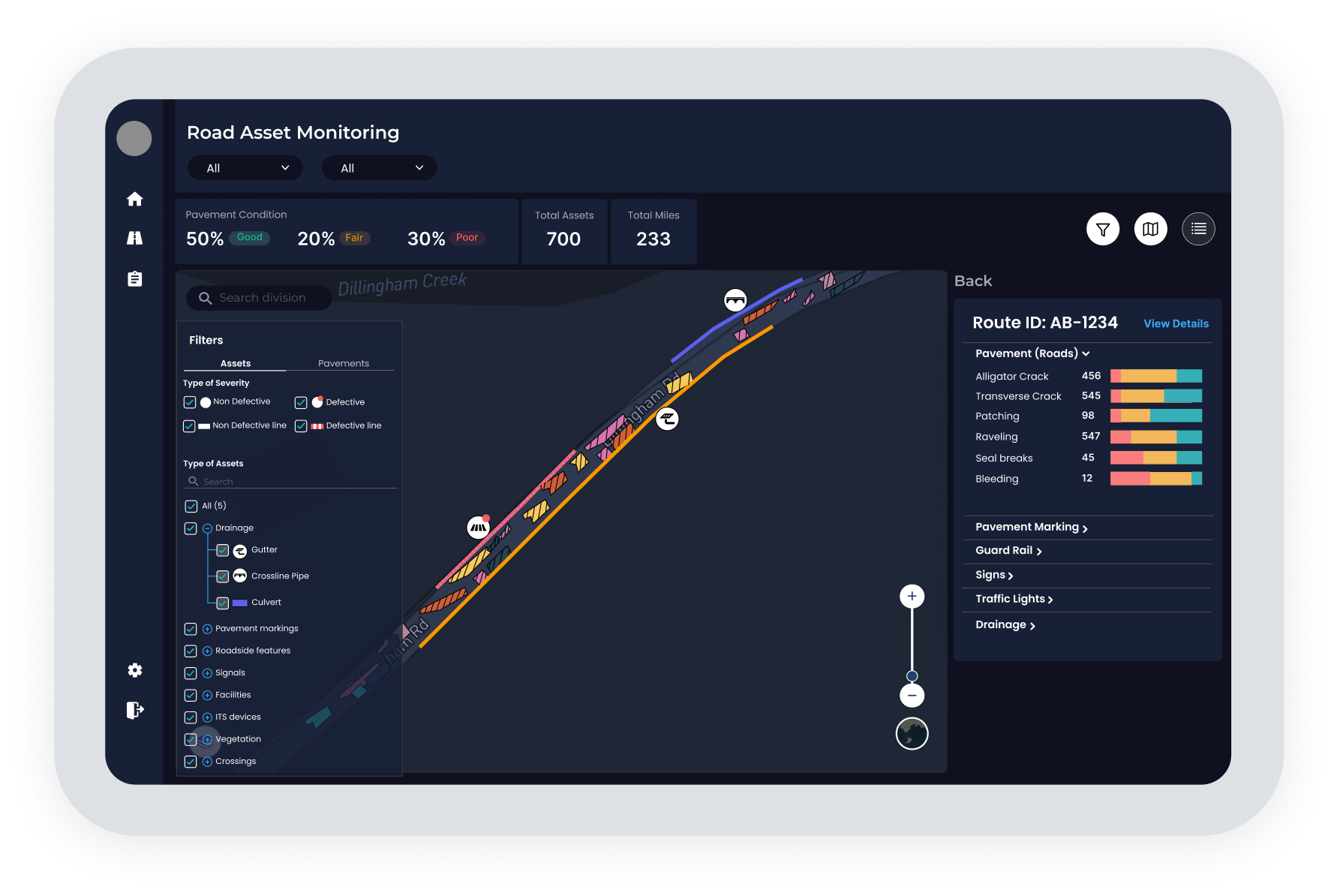
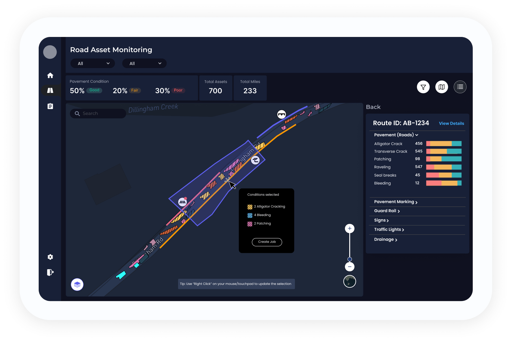
Combine satellite data, AI, and ground truth to detect, validate, and prioritize road conditions.
Adopt data-driven maintenance planning with multiple sources and rich analytics.
Customize reports to comply with current regulations.