7 must-have features for satellite-powered vegetation management
Satellite-powered vegetation management can do some amazing things. It’s common to see grid reliability increase more than 10% while actually spending 20% less on vegetation management, by working in the right place, at the right time.
But as you explore options to figure out which vendor is the best fit for you, there are a few must-have features that you need to be successful.
1. Actionable data
Any good satellite-powered vegetation management tool must be actionable. Just getting a scan and being told “you should send a crew to check out this problem area” isn’t actionable.
You likely know a lot of your problem areas. You need to uncover insights and truly be able to perfect your program. For instance, you should be able to plug in your budget and get a list of priorities based on reliability and risk impact.
2. GIS shapefile correction
The quickest way for an unsuccessful satellite pilot is to work with a bad GIS shapefile. Otherwise, you’ll never have an accurate read on vegetation distance from the conductor.
A lot of vendors claim they have a solution for this, but few actually do. Try and get specifics on this if you can. If you can’t, ask to speak to a customer to get a reference on accuracy.
3. AI recommendations
Imagery on its own isn’t helpful. Adding AI analysis on top of that imagery is where the magic happens. If the data analysis and AI recommendations don’t come with the imagery, you’re wasting money.
4. Connection with the rest of your tech stack
Vegetation management typically doesn’t have as many applications to deal with as other functions, but it’s still important to evaluate if you have other tools with overlapping capabilities, or if you can get an integration between your current tools and a satellite tool.
5. Executive-level dashboard all the way through to field crews
There should be dashboards, reports, and insights that are useful at all levels, from executives down to the field crews. For example, a mobile app is incredibly useful for people in the field, and a performance dashboard will have insights an executive or program manager wants to see.
6. Tree health monitoring
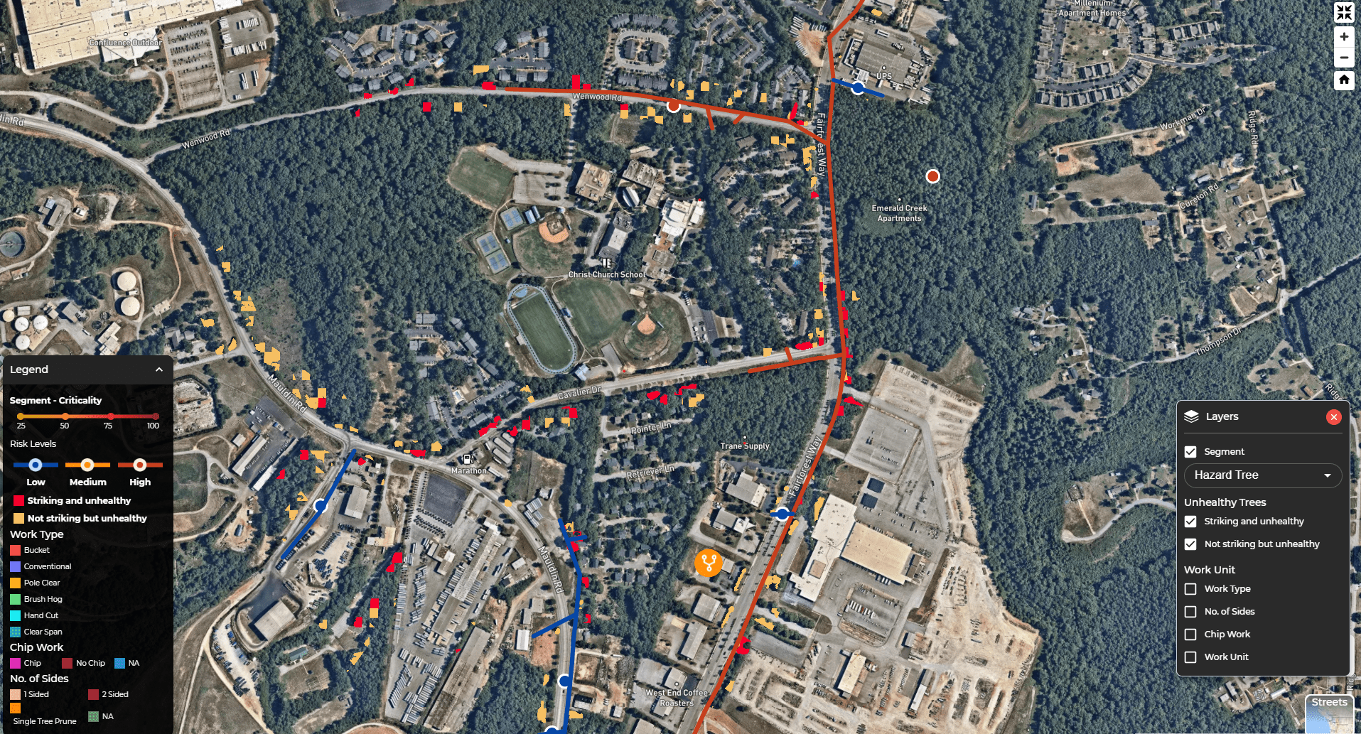
Recent advancements have unlocked tree health monitoring to proactively identify, categorize, and mitigate hazard trees before the cause outages. This feature should be at the top of any must-have list.
7. Work type identification
The difference between a bucket truck, jarraff, or climbers can be huge, both in time and money. Having a solution automatically identify what equipment and crews are needed based on topography, weather, access, and vegetation density can give a massive boost to efficiency.
Plus, some systems can even automatically create and approve work plans based on your preset criteria and flag any exceptions for review to further speed up the process.
The best way to determine if a satellite-powered vegetation management tool will meet your needs is to see it for yourself. Book a demo with one of our product experts today!