AIMSTM

Asset Inspection
and Monitoring SystemTM

Manage your assets faster and more effectively with highly accurate, precise geospatial datasets.

Get a Demo

News Flash: AiDASH Launches First-of-its-Kind Full Stack Platform for Grid Inspection and MonitoringLearn More!

More than 135 electric and gas utilities of all sizes across the globe use AiDash

Faster Icon
70%
Reduction in digital twin
creation timelines
5x
Faster network
survey time
World Map

Conflation

Merge datasets
for a more
accurate picture 

Asset health 
inspection 

Visualize and maintain
assets 

Generate precise views for asset management

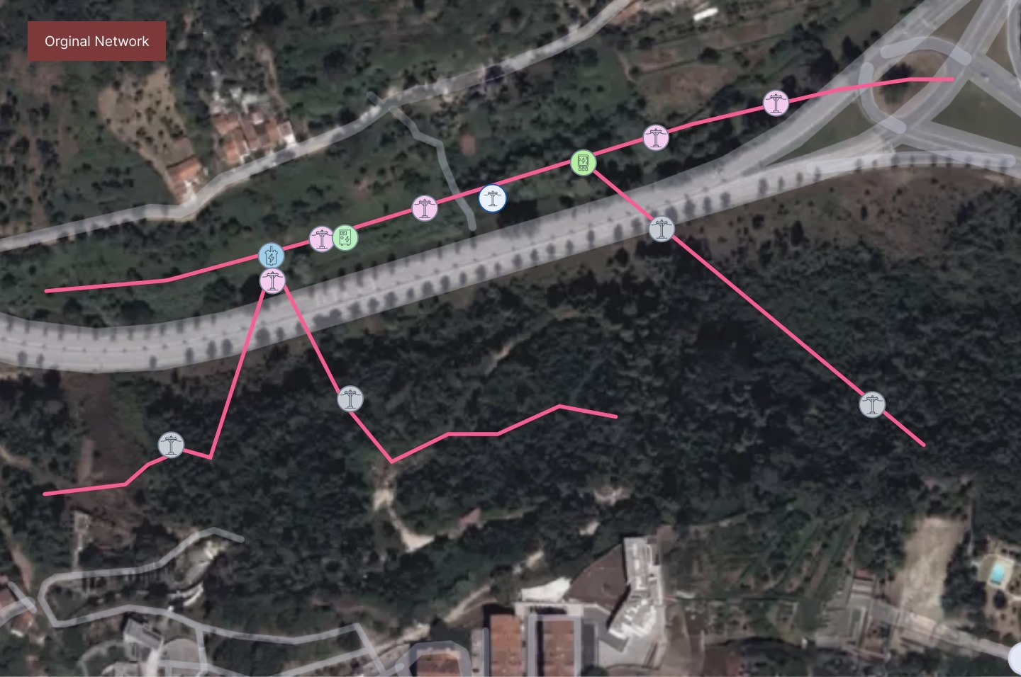
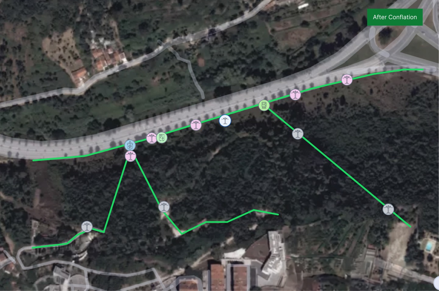
Conflate data from across utility assets for on-target planning. Avoid design and safety issues from inaccurate GIS readings. Reduce costs, complexities, and manpower needs with heightened accuracy: 


  • Overlay asset GIS data with aerial, ground, and satellite imagery.
  • Create highly accurate and precise geospatial datasets.
  • Maintain accurate and high-quality network data.

before shift after shift

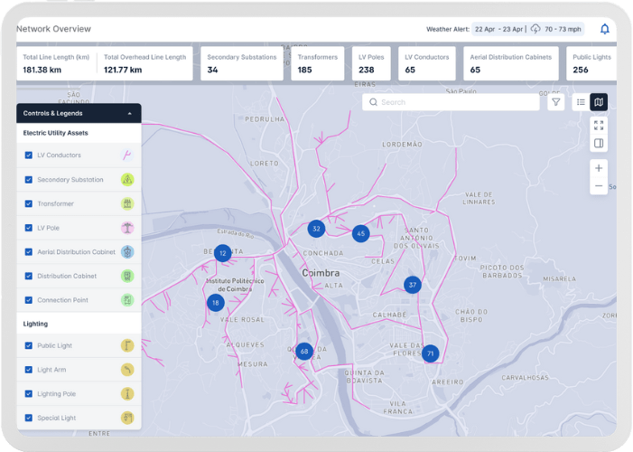
Visualize digital twins and prioritize asset health

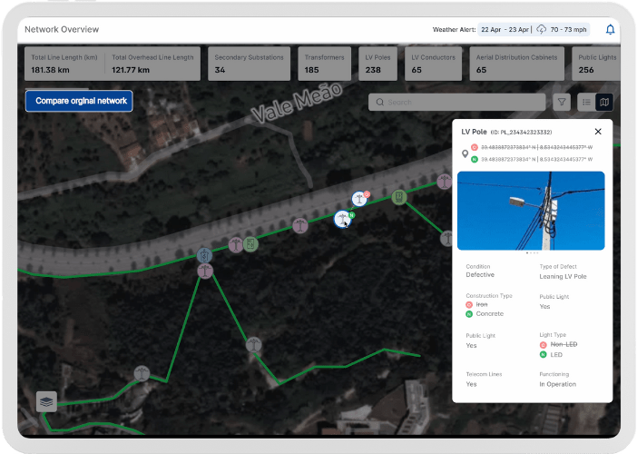
AIMS seamlessly exchanges accurate geospatial data with network design systems and advanced distribution management systems. With near-perfect digital twins, the system provides accurate visualization of current asset status. Best-practice asset management starts with correct data.

  • Manage full asset life cycle — maintain repair and improvement history, prioritize health, adopt condition-based maintenance.
  • Spot defective assets — leaning or cross-arm poles, nonfunctioning lights.
  • Minimize difference between as-designed and as-built networks.
  • Reduce network creation timelines by 70%. 
Visualize digital twins and prioritize asset health

Improve operational efficiencies for right place, right time responses

No need to fly drones or planes to capture and update imagery. AIMS cost-effectively creates a near perfect digital twin of your network for efficient, informed decision-making — avoiding misdirects to field workers from inaccurate geolocations.

  • Identify unhealthy assets and safety concerns.
  • Direct field crews to exact asset locations requiring maintenance or repair.
  • Support accurate network connectivity for grids to improve reliability.
Improve operational efficiencies for right place, right time responses